
Guests
- Seán Kinanenews and public affairs director at community radio station WMNF in Tampa, Florida.
As Hurricane Ian is set to strengthen into a Category 4 or 5 storm and make landfall Wednesday afternoon south of Tampa Bay, the storm already knocked out power in Cuba and killed at least two people Tuesday. Communities across Central Florida are preparing for a “very strong storm,” says Seán Kinane, news and public affairs director at Tampa community radio station WMNF, and many acknowledge the strength of the hurricane is “definitely impacted by climate disruption.”
Transcript
AMY GOODMAN: More than two-and-a-half million people in Florida have been ordered to evacuate as Hurricane Ian strengthens into a Category 4 storm, the storm already lashing the Florida southern tip, projected to make landfall this afternoon dozens of miles south of Tampa Bay. On Tuesday, Florida Governor Ron DeSantis urged residents to follow evacuation orders.
GOV. RON DESANTIS: There will be catastrophic flooding and life-threatening storm surge on the Gulf Coast region, and, of course, the highest risk will be in that southwest Florida region from Naples up to Sarasota. There’s also potential for flash flooding and river flooding with 10 to 20 inches across central and northeast Florida.
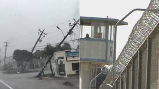
AMY GOODMAN: Hurricane Ian is approaching Florida after devastating Cuba. The storm knocked out power to the entire country, killed at least two people. Western Cuba suffered substantial damage. This is Abel Hernandez, a longtime tobacco grower in Cuba.
ABEL HERNANDEZ: [translated] It was disastrous. It was never seen this way before. Sometimes hurricanes pass through here, but not of this magnitude. It destroyed our houses, our tobacco drying huts, our farms, the trees, everything.
AMY GOODMAN: This all comes as about a third of Puerto Rico remains without power 10 days after Hurricane Fiona hit the island.
As Hurricane Ian approaches possible Category 5 status, we go to Tampa, Florida, where we’re joined by Seán Kinane. He is news and public affairs director at WMNF Community Radio.
Seán, thanks so much for taking a moment to join us on Democracy Now! as you are informing the public in Tampa Bay about the latest news, which is so critical to disseminate that kind of information. Tell us what you know at this point and what’s happening.
SEÁN KINANE: Thank you for having me on, Amy and Juan.
Yes, the hurricane is expected to be a Category 4 as it makes landfall south of Tampa, as you mentioned. It was a few days ago that here, us in the Tampa Bay area, we were very concerned about storm surges of eight to 10 feet in Tampa Bay, which would have completely inundated most of the low-lying areas of South Tampa and the barrier islands of the Pinellas County beaches.
Now it looks like they have been turned, that the storm has turned a little bit to the right, so more toward the east, and it’s going to make landfall south of the Sarasota area, which is south of Tampa Bay, for those people who aren’t familiar with the Florida area. But it will still be a very strong storm. The people in the Sarasota and Lee County areas are expecting very strong conditions. But it’s also going to move through the center of the state and cause a lot of rainfall, as Governor DeSantis mentioned in the clip that you played. And we are bracing for winds, rain and storm surge all through the west central Florida area.
JUAN GONZÁLEZ: And, Seán, what would it have meant if the storm made a direct hit on the Tampa area, Tampa-St. Pete? Obviously, St. Pete, out even further westward, would be even more exposed. Tampa is considered one of the most vulnerable cities in the world in terms of storm surges?
SEÁN KINANE: That’s right, Juan. Hurricanes of this strength have not hit the Tampa Bay region directly in more than 100 years. And forecasters are saying that when that does happen, when a large storm like Ian hits the Tampa Bay area directly, most of the region will be really devastated.
What could happen in Tampa itself, which is along Tampa Bay, a very shallow bay, and if the wind speed and direction is just right, it will push water up Tampa Bay and inundate very low-lying areas. Hospitals are there. The downtown city of Tampa is right there on the bay. And it would — you know, a 10-foot storm surge would be completely devastating for this region, in Tampa and, as you mentioned, in the barrier islands of St. Petersburg.
In fact, it’s speculated that if a Category 4 or 5 hit Tampa Bay directly, Pinellas County, which is a peninsula, would be essentially cut off into islands. And I would be living on one — I would have been living on one of those islands, which is one of the reasons why I evacuated to our radio station here, WMNF, because there would have been no way for me to have gotten off that island if there had been this kind of inundation that, luckily, in the Tampa Bay area and Pinellas County, we’re not subjected to, we’re thinking we won’t have. But that could happen in southwest Florida. There are barrier islands along Lee County and along Sarasota County that are certainly right in the path of this hurricane, Juan.
JUAN GONZÁLEZ: And also, the landfall is expected now around Fort Myers. But just inland from that is Immokalee, where many migrate farmworkers, who often live in substandard housing, live. Any sense or idea of what those migrant workers might be exposed to, what kind of shelter or even support from the state they’d be getting?
SEÁN KINANE: You know, a lot of the evacuation orders are ordered by zone, which essentially is how close you are to the coast and/or to rivers and how low-lying you are. But also those evacuation orders include substandard structures. If you are far inland and even on high ground, you have been asked to evacuate if you live in a mobile home or in a manufactured home or something that might not withstand strong winds.
Well, the Immokalee workers, the workers in Immokalee, Florida, are certainly living in those kinds of conditions, many of them, several families living under one roof, and it might even be a stretch to call it a roof. They definitely oftentimes live in substandard housing, which might be completely devastated in a hurricane like this. This harkens back perhaps to Hurricane Andrew in 1992 that came through Homestead, which is in South Florida, a large farming area near Miami, and a lot of the farms and the farmworkers were really impacted by Hurricane Andrew. You know, there’s no way to speculate what’s going to happen this afternoon, but it’s very likely that a lot of the community in Immokalee, a lot of those substandard structures will be probably completely destroyed in a huge hurricane like Hurricane Ian.
AMY GOODMAN: Seán, we just went — just before we went on the air, I watched DeSantis, the governor, giving a news conference, saying, actually, in some areas they’re telling people no longer to evacuate, to stay in place. You had officials saying wear helmets, you know, protect yourself, because they were saying it was too late. If you can talk about the significance of that, and also of WMNF, a treasure, your radio station, a gem of the community radio — in the community radio network around the United States? You focus a lot on climate change. I was just watching CNN last night, when they asked a guest about the link to climate, and he said, “I don’t want talk about that right now.” Well, Seán, you’ve always had that front and center in the news at WMNF.
SEÁN KINANE: Yeah. How can you not talk about climate change right now? And, Amy, I want to thank you for your support of Community Radio WMNF over the years. And thank you for saying those nice things. We are trying to keep our audience engaged and informed about this dangerous storm.
So, but turning to climate change, there is so much that can be linked to climate change in this storm. And, you know, meteorologists always say you can’t say any one particular thing about a storm is directly related to climate change. But you know what? Here’s what climate change has done. Climate change has made the waters warmer, and that causes storms to be stronger. Climate change has made more atmospheric moisture, which is — that’s one of the reasons why there’s going to be 24 inches of rain in Orlando this week. And also, climate change has made the seas higher, and they’re going to keep getting higher. And what that does is that increases the damage from storm surge. If you have 10-foot storm surge over today’s levels of climate — of sea level, that is, well, that’s certainly different than what would have been if the seas were one foot lower. So, all of these things are very much impacted by climate disruption.
AMY GOODMAN: Well, I want to thank you so much for being with us, Seán Kinane. I want you to be able to get back to work. You’re on the air nonstop, news and public affairs director, community radio station WMNF, I guess where you’re living right now, in Tampa, Florida. Please be safe. And we’re going to get back in touch to see how you’re doing and the community of Tampa Bay.
We’re going to break. When we come back, we’re going to be joined by Bill McKibben, author, educator, environmentalist, to find out why he was protesting the World Bank in Washington, D.C., yesterday, and also deeply concerned about what we’re seeing happen throughout the Caribbean into Florida right now. Stay with us.





Media Options